

ORTHO MAPPING
At Aerologic Solutions, we offer precise high resolution orthomosaic mapping deliverables to either serve as stand-alone existing condition maps, progression comparisions, or a basemap underlay to draft plaimetric linework from. Obtaining location data from our mapping delivaerables can result in reduction of field work by up to 70%. Every new project can start with an existing conditions map, accelerating the project timeline from day one and saving dozens of hours of field work.
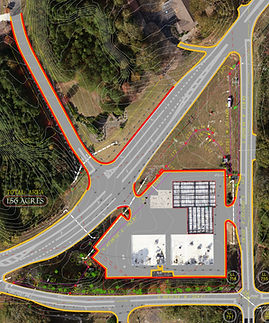


EXISTING CONDITIONS MAPPING

DRAFTING
SUPPORT
By using high resolution maps as a background layer, CAD drafting is made much more efficient and accurate. Ortho maps can be used as a sole source of location data, as well as a reference to check field run data for accuracy.

Project Progression Mapping
By utilizing flights at regularly scheduled intervals we are able to showcase the project's development thorughout its lifespan. This shows changes from flight to flight but also compares design vs site conditions to show discrepancies.